Animated Spatial Maps#
Introduction#
In this training, we plot animated maps varying with time using Python. Some of the material is taken from this blog post
Data Required : Multiple files are downloaded from this data source for the historical data. The variable selected is precipitation for the month of August for years 2000-2021.
This page covers the following elements
Plotting raster files
Animated plots with grey scale
Colored maps with legend and text
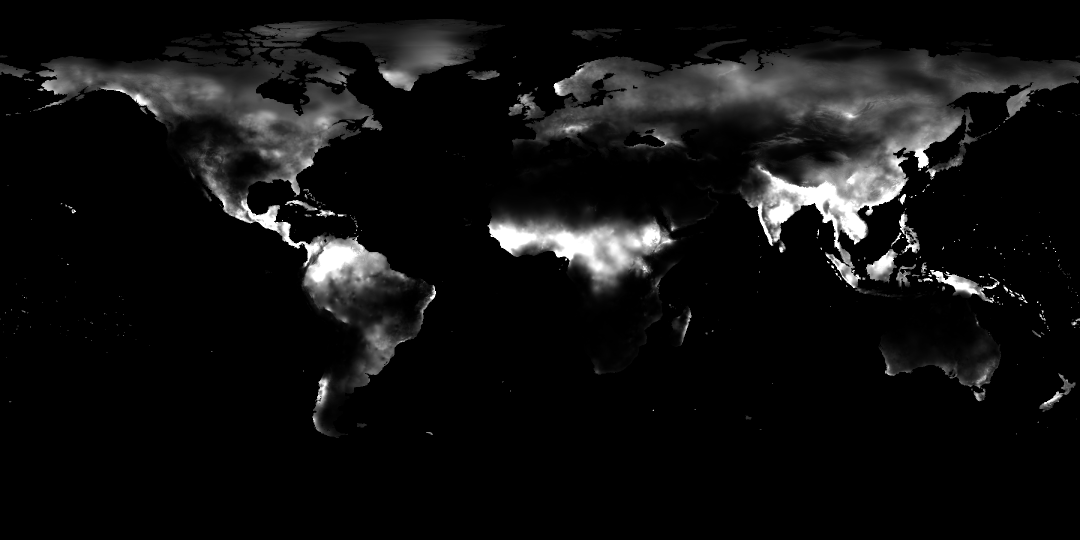
Plotting Raster File#
#plotting single raster file
import numpy as np
import matplotlib.pyplot as plt
import tifffile as tiff          # pip install tifffile

# Load the image
path = "SupportingFiles/wc2.1_10m_prec_2002-08.tif"
img = tiff.imread(path)
# plot the image
fig, ax = plt.subplots(figsize=(10, 10))
plt.imshow(img, cmap="viridis", vmin=0, vmax=150)
cbar = fig.colorbar(im, ax=ax, fraction=0.02, pad=0.04)  # tweak size/spacing
cbar.set_label("Precipitation")                            # colorbar axis label
plt.axis('off')
---------------------------------------------------------------------------
ModuleNotFoundError                       Traceback (most recent call last)
Cell In[1], line 2
      1 #plotting single raster file
----> 2 import numpy as np
      3 import matplotlib.pyplot as plt
      4 import tifffile as tiff          # pip install tifffile

ModuleNotFoundError: No module named 'numpy'
Plotting Animated Maps#
from PIL import Image
import glob
import numpy as np
import matplotlib.pyplot as plt

# Get all tif files in the current directory #different files could also be called as list of names
image_files = sorted(glob.glob("SupportingFiles/*.tif"))
#sorted() ensures frames are in the correct order.

# Open all the images
images = [Image.open(img) for img in image_files]

# Save as an animated GIF
images[0].save(
    "globe_Cost_Reduction_faster.gif",
    save_all=True,
    append_images=images[1:],
    duration=45 * 10,  # Convert delay from ImageMagick (1/100 sec) to milliseconds
    loop=0
)
duration=450 → because ImageMagick’s -delay 45 means 45/100 seconds per frame.
loop=0 → means infinite loop.
Plotting Animated Maps with colorbar and text#
import glob, io, tifffile as tiff, numpy as np, imageio.v3 as iio
import matplotlib.pyplot as plt
import os
frames = []
for tif in sorted(glob.glob("SupportingFiles/wc2.1_10m_prec_2*.tif")): #reading the selected files with name starting with
    data = tiff.imread(tif)

    fig, ax = plt.subplots(figsize=(10,10))
    # p2,p98 = np.nanpercentile(data,(2,98))
    im = ax.imshow(data, cmap="viridis", vmin=0, vmax=150) #vmin and vmax could be defined based on the percentile values or desired range
    ax.axis("off")
    cbar = fig.colorbar(im, ax=ax, fraction=0.02, pad=0.04)  # tweak size/spacing
    cbar.set_label("Precipitation")                            # axis label
    ax.set_title(os.path.basename(tif)[-11:-7], fontsize=14)   # title line
    # capture PNG bytes from the figure
    buf = io.BytesIO()
    fig.savefig(buf, format="png", dpi=120, bbox_inches="tight", pad_inches=0)
    plt.close(fig)
    buf.seek(0)

    frames.append(iio.imread(buf))           # convert PNG to ndarray

# save GIF
iio.imwrite("stack.gif", frames, fps=2, loop=0) #fps is frames per second
print("stack.gif created with", len(frames), "frames")
stack.gif created with 22 frames
