WaterPaths#
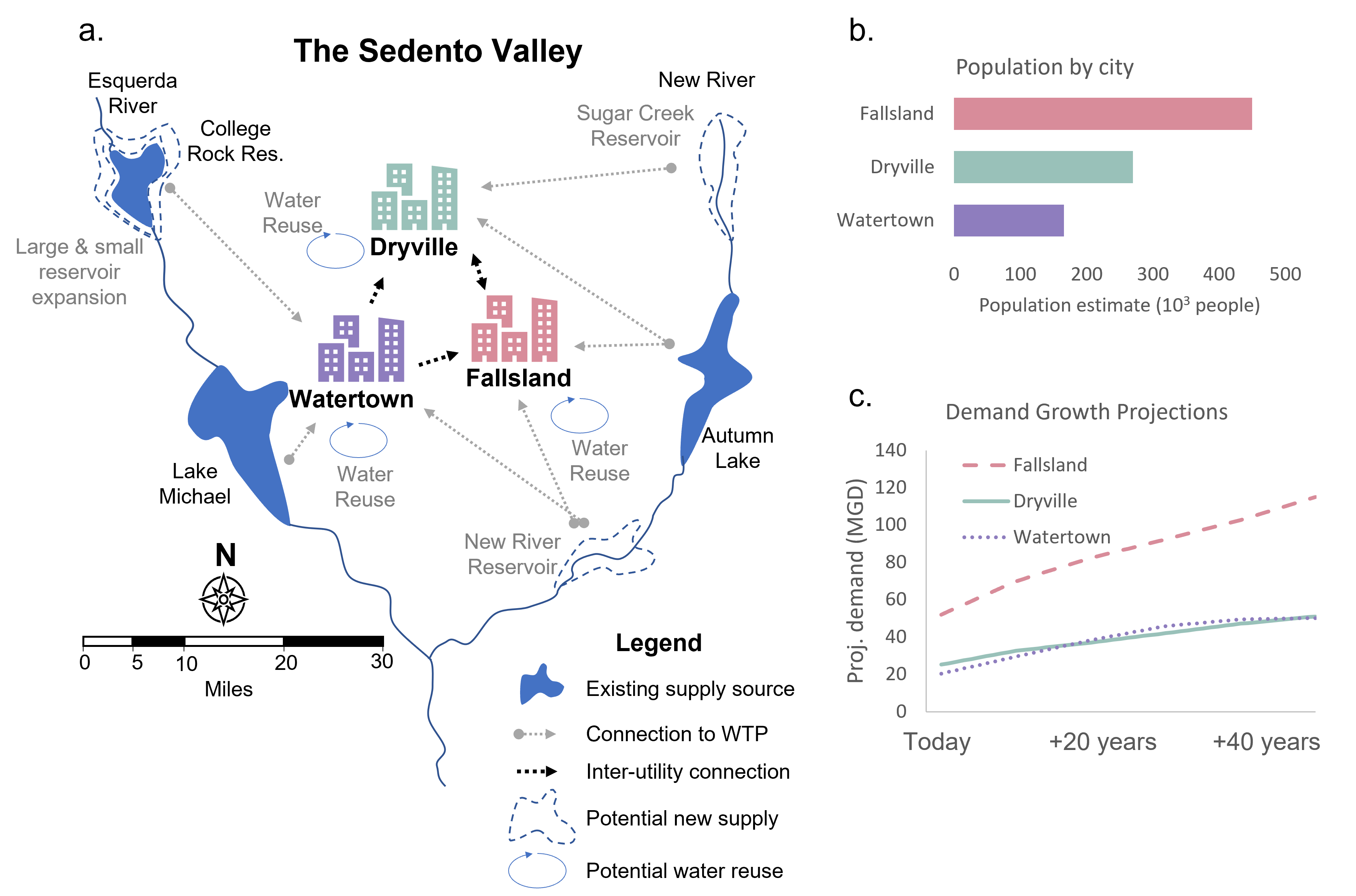
WaterPaths is a generalizable, cloud-compatible, open-source exploratory modeling system designed to inform long-term regional investments in water infrastructure while simultaneously aiding regions to improve their short-term weekly management decisions, often made in response to droughts. WaterPaths has the capability to identify coordinated planning and management for groups of water utilities sharing water resources. WaterPaths’ exploits dynamic and adaptive risk-of-failure (ROF) rules to trigger management and planning actions in temporally consistent pathways. The C++ source code and instructions for use can be found at on Github.